Urmia (Orūmīyeh)
 |
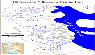
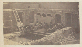
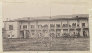
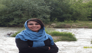
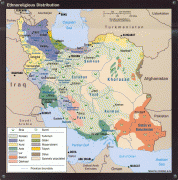
Urmia is the 10th-most populous city in Iran. At the 2012 census, its population was 667,499, with 197,749 households. The majority of the city's residents are Azerbaijanis, with a large minority of Kurds, and a smaller number of Assyrians, and Armenians, as well as Persian-speakers who moved to the city mostly for employment. The city is the trading center for a fertile agricultural region where fruits (especially apples and grapes) and tobacco are grown. Even though the majority of the residents of Urmia are Muslims, the Christian history of Urmia is well preserved and is especially evident in the city's many churches and cathedrals.
An important town by the 9th century, the city has had a diverse population which has at times included Muslims (Shias and Sunnis), Christians (Catholics, Protestants, Nestorians, and Orthodox), Jews, Baháʼís and Sufis. Around 1900, Christians made up more than 40% of the city's population; however, in the next decades, most of the Christians were either killed as a part of the advancing Ottoman troops and raids by Kurdish tribes or fled shortly after the end of the war.
Richard Nelson Frye suggested Urartian origin for the name, while T. Burrow connected the origin of the name Urmia to Indo-Iranian urmi- "wave" and urmya- "undulating, wavy".
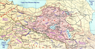
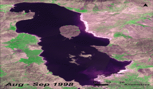
The name could also derive from the combination of the Assyrian Aramaic words Ur (ܐܘܪ; a common name for cities around Mesopotamia, meaning "city") and Mia, "City of Water" referring to the great Lake Urmia nearby. Compare Urhay, Ur of the Chaldees.
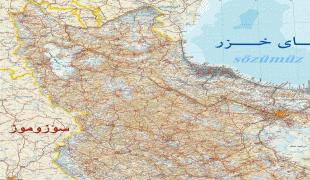
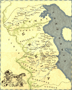
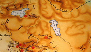
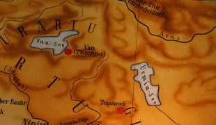
Map - Urmia (Orūmīyeh)
Map


Country - Iran
 |
 |
| Flag of Iran | |
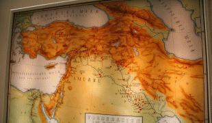
The country is home to one of the world's oldest civilizations, beginning with the formation of the Elamite kingdoms in the fourth millennium BC. It was first unified by the Medes, an ancient Iranian people, in the seventh century BC, and reached its territorial height in the sixth century BC, when Cyrus the Great founded the Achaemenid Persian Empire, which became one of the largest empires in history and a superpower. The Achaemenid Empire fell to Alexander the Great in the fourth century BC and was subsequently divided into several Hellenistic states. An Iranian rebellion established the Parthian Empire in the third century BC, which was succeeded in the third century AD by the Sassanid Empire, a major world power for the next four centuries. Arab Muslims conquered the empire in the seventh century AD, which led to the Islamization of Iran. It subsequently became a major center of Islamic culture and learning, with its art, literature, philosophy, and architecture spreading across the Muslim world and beyond during the Islamic Golden Age. Over the next two centuries, a series of native Iranian Muslim dynasties emerged before the Seljuk Turks and the Mongols conquered the region. In the 15th century, the native Safavids re-established a unified Iranian state and national identity, and converted the country to Shia Islam. Under the reign of Nader Shah in the 18th century, Iran presided over the most powerful military in the world, though by the 19th century, a series of conflicts with the Russian Empire led to significant territorial losses. The early 20th century saw the Persian Constitutional Revolution. Efforts to nationalize its fossil fuel supply from Western companies led to an Anglo-American coup in 1953, which resulted in greater autocratic rule under Mohammad Reza Pahlavi and growing Western political influence. He went on to launch a far-reaching series of reforms in 1963. After the Iranian Revolution, the current Islamic Republic was established in 1979 by Ruhollah Khomeini, who became the country's first Supreme Leader.
Currency / Language
| ISO | Currency | Symbol | Significant figures |
|---|---|---|---|
| IRR | Iranian rial | ï·¼ | 2 |
| ISO | Language |
|---|---|
| KU | Kurdish language |
| FA | Persian language |